

“The entire world could end and we wouldn’t even know.”
Justin Lowery said that once. Or maybe it was me. Honestly it’s tough to remember at this point as it happened over two years ago. What I do know is that he and I once socially distanced at a truly epic level. That word gets thrown around a lot in reference to photography, but in this case it was true. So here’s the story about how he and I once went 5 days without seeing another human. The world really could have ended and we would not have known. We were socially distancing long before it was mandatory!
Prologue
A little background first though. I’m a thorough researcher. When getting into large format, I bought all the books on the subject that I could find. When I read through those (thanks Ansel Adams for posthumously teaching me the fundamentals!) I went to YouTube. It was there I discovered some guy named Ben Horne (maybe you’ve heard of him) and learned of his penchant for this collection of canyons called Zion. All it took was seeing one video of the Virgin River Narrows and I was hooked. I simply HAD to visit this place! It sounds strange to say now, but at that point in my life (circa 2011) I had no idea rivers could be next to vertical canyon walls. Growing up in the rolling hills of Tennessee, this was completely foreign to me. So, as with all things, before I visited, I had to research Zion. Following a similar pattern I bought up all the hiking guide books I could find and then, once those were exhausted, I turned to the internet.
Subway, the Narrows, Angels Landing…they were all covered very thoroughly. I started to mentally map out all of the iconic shots I wanted to take on my first trip. Once familiar with those, I started to research the more obscure locations: Clear Creek, Northgate Peaks, The Kolob Canyons…I knew it all like the back of my hand. And then there was the Barracks. Ever heard of it? Probably not, because even in my YouTube journals and when discussing it on the Large Format Photography Podcast I never mentioned the name. That’s by design as I didn’t want it to become overrun. So I’m letting you into the Large Format Circle of Trust here. If you go there, don’t ruin it!!
So back to the Barracks. It was a hike that promised Narrows like scenery, epic (that word again) adventure, and at least a multi-day backpacking trip. That was a minor issue because at that point I had approximately zero backpacking experience. So for the time being, I stored the Barracks in the back of my mind and concentrated on exploring Zion through day hikes. As I progressed in my large format experience, I gradually started to want to branch out further than just day hiking. I had my fill of the icons; I wanted to explore areas where most people don’t take cameras, and that meant hiking further than I could make it in a single day. Backpacking was the answer.
Again, books and the internet told me everything I needed to know about backpacking. Even though the chapters about backpacking with large format gear were strangely missing, I was confident I could adapt; the Barracks were starting to almost, kind of, possibly be doable!!
Until I made my first trip. In hindsight, perhaps I shouldn’t have made my first backpacking-with-LF-gear a 3-day experience when rain was predicted for days 2 and 3. With thunder rumbling through the Smoky Mountains, I did manage to stay dry (and even took one of my favorite images of the Smokies) but my morale was shot. I returned to my truck with my tail tucked between my legs, exhausted after only one night on a relatively flat trail. I had a MAJOR problem…weight. My pack was just too heavy. How was I supposed to hike nearly 30 miles spanning multiple days in unforgiving terrain when I could barely make it one night on a flat trail. The Barracks once again faded into the back of my mind.
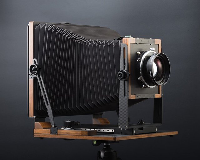
And it promptly returned to the forefront the day I met Justin Lowery. As with most in the large format community, Justin and I knew each other through social media. After finding out our time in Zion one year would overlap, we met up, and as most photographers do, we compared gear! He was shooting a generation 1 Intrepid 4×5 at the time. Back then I was only vaguely aware of Intrepid. I seemed to remember seeing a startup company on GoFundMe. It was encouraging to see some new developments in LF, but that prototype was UGLY! Do you guys remember seeing the front standard supports made out of plywood?! Anyway, I dismissed the camera based on looks alone. In retrospect, perhaps I shouldn’t judge a camera based on its prototype, because Justin showed me the Intrepid, and to my surprise, it was a sharp-looking camera. But even more importantly, it weighed nothing. I returned from Zion and immediately placed an order. With my gen 2 camera in hand, the Barracks was now a distinct possibility!
I ran the idea by Justin and he was crazy enough to join me. We spent the next year trying gear, refining our systems, and planning the hike. From what little we found in guide books and online, we mapped out potential photography hotspots, places to overnight, and areas we could bail out if we needed to. We settled on a 5 day, four-night adventure; carrying enough food was the limiting factor. With packs loaded, and waypoints saved into a handheld GPS, we embarked on the adventure of a lifetime.
Day 1
The Barracks is a through-hike meaning we needed to arrange a shuttle for drop-off and have a car parked for pickup. I arranged the shuttle through a local outdoor outfitter, and we arrived at Zion Outfitters at 6 a.m. on a brisk October day. Justin left his truck at the Checkerboard Mesa parking lot with a note about our expected arrival date and time. We had notified park rangers of our plans and they wished us luck…and told us not to get lost or hurt. Rescues in the area would be difficult and could potentially take several days. What a confidence boost!! With temps hovering in the low 30s, our shuttle made its way to the Barracks trailhead. I use that term loosely as there is no official beginning to the trail; you just drive as far downriver as possible and then start hiking.
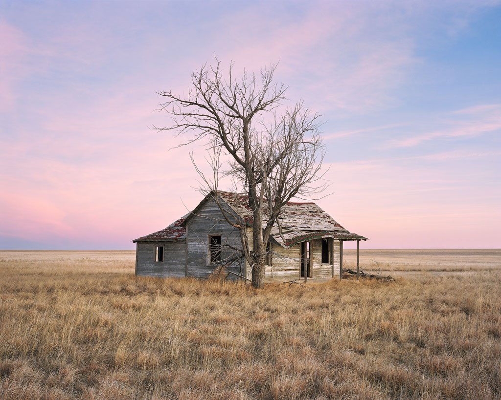
Speaking of a river, I guess now is as good a time as any to paint a picture of exactly what the Barracks hike is. The Barracks (disappointing named, I discovered, after a family ranch and not an ominous prison) is a canyon system along the East Fork of the Virgin River (as opposed to the North Fork that makes up the more famous Narrows). Starting in the widely spaced white sandstone cliffs to the east of Zion National Park, the river gradually carves a deep East/West canyon along its course. Along the way, several slot canyons branch off offering potentially breathtaking photographic opportunities. These canyons, and the deeper chasm further down the main river, were what we were after, but it was going to take effort to get there.

(Sunlight on the white cliffs and the meandering East Fork of the Virgin River.)
Well before the sun made an appearance, we stepped out of our offroad shuttle to begin our adventure. Let me tell you, the cold hits differently when you step out of the vehicle and have a river crossing in the first 100 yards of your hike! At this stage, the East Fork is more of a meandering creek, with heavy emphasis on the word meandering. With no trail to follow, it was a constant judgment call of when to cross the river, when to hike in the river, and when to stay on dry ground. This was actually not that easy as getting in and out of the river required quite a bit of effort. The banks were quite tall and mostly sand or overgrown. Travel was slow and arduous, but as the sun crested the white cliffs behind us, team morale took a noticeable turn for the better!

(As you can see, getting out of the river was no easy task!)
And then I stepped in quicksand. Through reading what little I could find on this hike, the word quicksand continuously made an appearance. Not saying I brushed it off, but it didn’t concern me too much until I stepped in it. At this point I should mention that the river is quite silty; so silty in fact that you cannot see what you are walking in. As we were hiking in the river, I took one step that was ankle deep and the next unknowingly went mid-thigh. If you’ve never hiked in quicksand before, it’s best to imagine walking on jello. If you walk quickly you can stay on top of it, but if one-foot plants too firmly you’ll sink. This is the predicament I found myself in. To be clear, this was in no way dangerous. However, my options were limited. The current was too strong for me to step out of the pothole and backtrack. A quick depth check with my trekking pole told me that another step down river would’ve placed the water at chest level. This was not an option as I was carrying all my camera gear (and everything I needed to stay warm on this trip) on my back. In order to save weight we decided to forego any type of dry bag; if I got soaked, the gear got soaked. Thankfully, Justin was behind me. He shed his pack to the bank, and then extended a trekking pole. I grabbed hold and extricated my leg from the predicament. Disaster averted!
Again, that wasn’t dangerous, but from then on, the seed of doubt was planted. Was the next step I took going to plunge me even deeper? We developed a method of tapping our trekking poles in front of us to test depth. This helped, but I can’t lie…I enjoyed the hike much more for the portions when Justin was leading! :) I brought along the full video kit for this trip as I wanted to document as much as possible. However, the hiking was so difficult that I was not able to capture much of the hike itself. We did take occasional breaks whenever we found a freshwater spring; the silty, animal carcass (true story; multiple dead deer) filled East Fork just wasn’t going to cut it as a water source. During these times I would grab some video to hopefully tell our story. As an aside, this is some of my all-time favorite drone footage; not being in a National Park has its benefits!
After taking 5 hours to hike 6 miles, we arrived at the confluence of the Barracks and Mineral Gulch. Mineral Gulch is a series of extremely narrow slot canyons and a source of freshwater. Thankfully, at the mouth of this canyon was a little peninsula of land that made the perfect spot to set up camp. There was a flat area relatively close to the river where I could pitch my tent and Justin his tarp. We had to be a little careful here as we were on sand and not compacted dirt. Driving a tent stake and then applying too much pressure would’ve caused the sand to separate and fall into the river; picture a glacier cracking and falling into the ocean. Difficulties aside, we got camp set up and still had enough daylight to explore and photograph Mineral Gulch.

(The best campsite we could’ve hoped for…just as long as the sand didn’t cave in! Notice how silty the East Fork is.)
With camping gear offloaded, my backpack now barely even registered as being on my back. Also, Mineral Gulch is mostly dry and flat so covering terrain was much easier now. We traversed the north/south canyon several times searching for the best reflected light. At one point, I found an intense glow, but by the time I had my camera up and focused, it was too late. It was becoming apparent that we had missed the best light. Not a huge worry as we had designated another full day to explore this slice of photography paradise. One highlight of the day was coming across a brilliant cottonwood in front of a bright reflected light wall. This was extremely lucky as most trees had unfortunately already shed their leaves; so much for capturing fall color on this trip. Justin and I both photographed this tree and then returned to our campsite for dinner and some rest.

(Beautiful reflected light in one of the narrows of Mineral Gulch.)

(The only tree on the entire trip that showed any color…and it just happened to be in front on an orange wall!)
It turns out our little peninsula of land was just about the perfect campsite (the risk of the sand caving in and falling in the river notwithstanding of course). Flash floods had eroded some areas at just the perfect sitting height. I can’t tell you how great it felt to get in some dry clothes and sit down after a long day! We even had time to build a campfire. Once the sunset, I changed out film. This was a real exercise in organization as I only brought two boxes. One contained packets of Ektar, Velvia, and Delta 100 and the other was for unloading sheets from my four film holders. I carefully recorded the order which I unloaded the film, and then reloaded everything for the following day. With nothing left to down, I got in my tent and went to sleep to the sounds of the Virgin River.

(Forbidden Temple 4×5 Kodak Ektar 100)

(Fading 4×5 Fuji Velvia 50)

(Yin and Yang 4×5 Fuji Velvia 50)
Be sure and come back for Part 2 of this trip as Justin and I explore more of this beautiful canyon system.
0 Comments